P.A. MILLER SURVEYING LTD
Ontario Land Surveyors · Canada Lands Surveyors
Reliable, High Quality Surveying Services
On time and on budget since 1980!
Photogrammatic Surveys
Providing reliable, high quality legal survey services, on time and on budget in Eastern Ontario, since 1980.
What is it?
It is the science of making measurements from photographs, especially for recovering the exact positions of surface points. Photogrammetry is as old as modern photography, dating to the mid-19th century and in the simplest example, the distance between two points that lie on a plane parallel to the photographic image plane, can be determined by measuring their distance on the image, if the scale (s) of the image is known (source Wikipedia)
How Does P.A. Miller Surveying Do It?
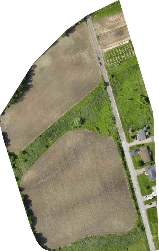
We fly our sites with our SenseFly eBee UAV (or drone) or DJI Phantom and image the ground with an onboard digital camera. The images, and associated geo-referenced control targets, are post processed in PIX4D software to geo-reference, scale correct and build a 3 dimensional Digital Surface Model (DSM) and colour mosaic of the entire site.
How Can I Use the End Products?
Many clients are only interested in the colour orthomosaic as it is an excellent backdrop for any type of project. Since it is geo-referenced it can easily be assimilated with projects where the datasets are also geo-referenced – for example, legal survey drawings, topographic surveys and GIS data. Where ground conditions are open and we can image the bare earth, we can produce some excellent contour datasets with typical accuracies ranging between 5 to 20 cm vertically. We have been performing these surveys over the past few years for Topographic Surveys, Stockpile Surveys and Mapping Projects.

Sample Project (done in 2017)
Flight Time: 17 minutes with 212 images acquired
Flight Altitued: 124 meters, area image – 9.0 hectares
Our surveying services
What We Do
Boundary Line Markouts
Shore Road Allowance
Photogrammetric Surveys
First Nations Land Surveys
Severance
Surveys
Drone
Surveys
Other
Services
SURVEY ESTIMATES ARE FREE
Click on the button to go to our survey estimate request form.